Hello,
If anybody has alittle spare time, I was wondering if they could fly into an airport for me and tell me if the terrain for that airport is correct on their computer.
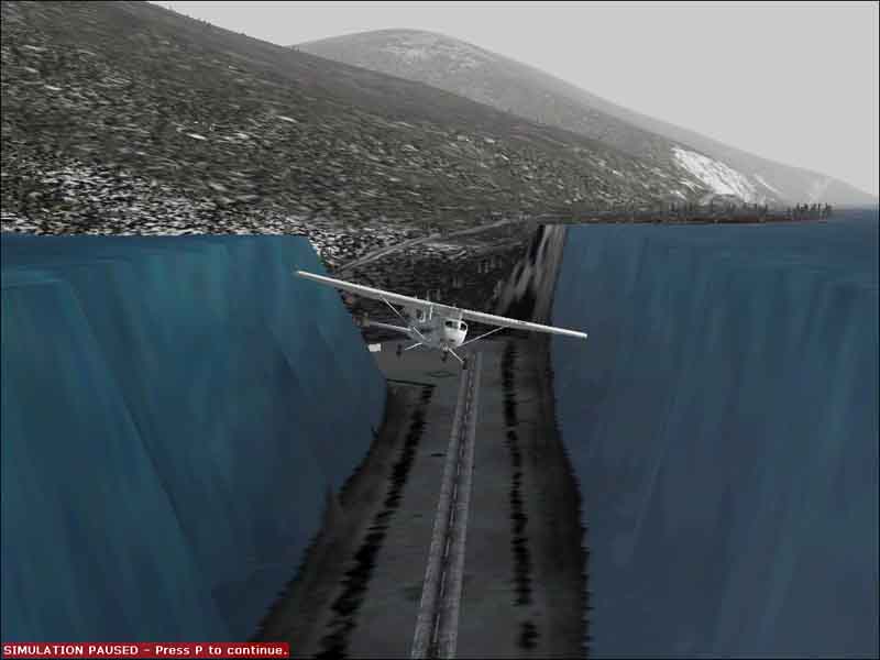
The airport in question is Revelstoke, British Columbia, Canada, Airport code CYRV.
The water textures follow the ground elevation changes, and I feel like moses separating the sea as I land there. I should take a screen shot...
Anyway, thanks for your time and help.
Simviation Forums
Flight Simulator and other chat