
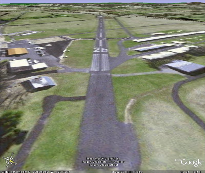
P.S.- The airport is my home airport, Alexandria (N85)
Flight Simulator and other chat
![]() by flyboy 28 » Sun Oct 23, 2005 5:38 pm
by flyboy 28 » Sun Oct 23, 2005 5:38 pm
![]() by gn85 » Mon Oct 24, 2005 10:19 am
by gn85 » Mon Oct 24, 2005 10:19 am
![]() by Ivan » Mon Oct 24, 2005 10:37 am
by Ivan » Mon Oct 24, 2005 10:37 am
![]() by ATI_7500 » Mon Oct 24, 2005 1:23 pm
by ATI_7500 » Mon Oct 24, 2005 1:23 pm


![]() by flyboy 28 » Mon Oct 24, 2005 2:08 pm
by flyboy 28 » Mon Oct 24, 2005 2:08 pm
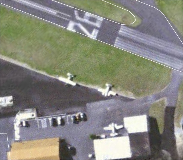
i see a dc-3 there...
You're a little high
And turn on AA and autogen.
![]() by neodug » Mon Oct 24, 2005 3:24 pm
by neodug » Mon Oct 24, 2005 3:24 pm

![]() by flyboy 28 » Mon Oct 24, 2005 7:50 pm
by flyboy 28 » Mon Oct 24, 2005 7:50 pm
![]() by A/SGT.Mav316 » Mon Oct 24, 2005 9:25 pm
by A/SGT.Mav316 » Mon Oct 24, 2005 9:25 pm

![]() by The_Joker_Flyer » Tue Oct 25, 2005 10:06 am
by The_Joker_Flyer » Tue Oct 25, 2005 10:06 am


![]() by Fozzer » Tue Oct 25, 2005 11:54 am
by Fozzer » Tue Oct 25, 2005 11:54 am
I've always wished Google Earth could be tied into FS9. That's be really slick.
 ...!!...!
 ...!
...!
![]() by gn85 » Tue Oct 25, 2005 2:42 pm
by gn85 » Tue Oct 25, 2005 2:42 pm
Remember that Google Earth and VFR Photographic Scenery are just FLAT 2-dimensional photographs.
You really wouldn't want them to replace the default Autogen, and downloaded 3-D scenery...trust me...
If you landed in 2-D scenery, everything would be FLAT for as far as the eye can see...no buildings, no ground AI aircraft, no bridges, no trees, no nothing.....
...just a flat photograph laid over undulating scenery mesh...
Fine at 2000+ feet AGL....REALLY NAFF on the ground...
Cheers all...!
Paul...(threw my Photographic VFR Scenery away years ago, ....back to Autogen)...
 Googe Earth CAN impose some buildings into 3D in more built up areas, but it still wouldn't be like autogen.
 ![]() by A/SGT.Mav316 » Tue Oct 25, 2005 5:27 pm
by A/SGT.Mav316 » Tue Oct 25, 2005 5:27 pm
![]() by Splash » Tue Oct 25, 2005 6:47 pm
by Splash » Tue Oct 25, 2005 6:47 pm
![]() by congo » Tue Oct 25, 2005 8:31 pm
by congo » Tue Oct 25, 2005 8:31 pm
 Mainboard: Asus P5K-Premium, CPU=Intel E6850 @ x8x450fsb 3.6ghz, RAM: 4gb PC8500 Team Dark, Video: NV8800GT, HDD: 2x1Tb Samsung F3 RAID-0 + 1Tb F3, PSU: Antec 550 Basiq, OS: Win7x64, Display: 24&
Return to Simulation Screenshots Showcase
Users browsing this forum: No registered users and 489 guests