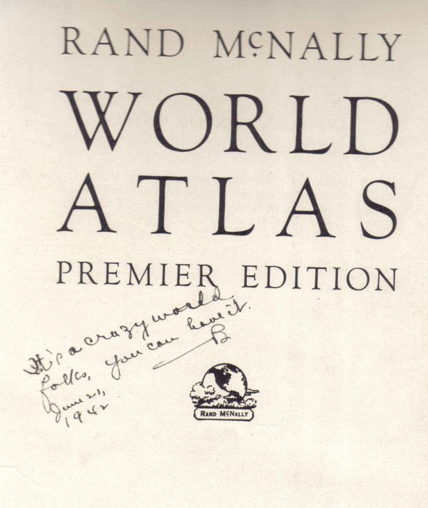
I'm a sucker for old maps, and this complete World Atlas, ca. 1942, was a nice find. It's very big, but I had to try to scan a few parts.
I love the inscription on this page... remember that WWII was in full swing at the time. Funny, just not ha-ha funny.
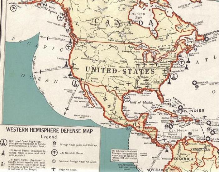
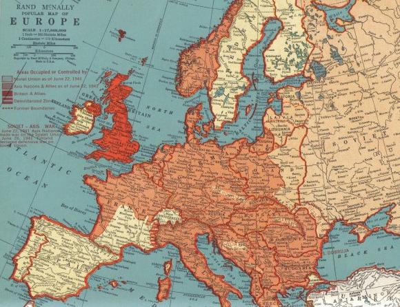
Some fascinating wartime territory maps in here... fortunately, they were already loose, thus easier to scan. Interesting that all of this US Defense info was published during the war... but I guess this stuff was established well before the war; common knowledge worldwide already.
Sorry this map of Europe is somewhat illegible... if anyone would like a closer look, I can try a re-crop that shows more detail of a smaller area.
And check out this nice bonus: tucked just inside the cover, a class portrait of some 5th-graders from NYC, ca. 1949. Not pictured here is the 48-star flag hanging on the wall. Hard to believe all of these cute little nippers are either over 60 or dead now... except for the clothes and the hair, they could be any bunch of present-day American middle-schoolers.They all look familiar to me somehow; a weird phenomenon.
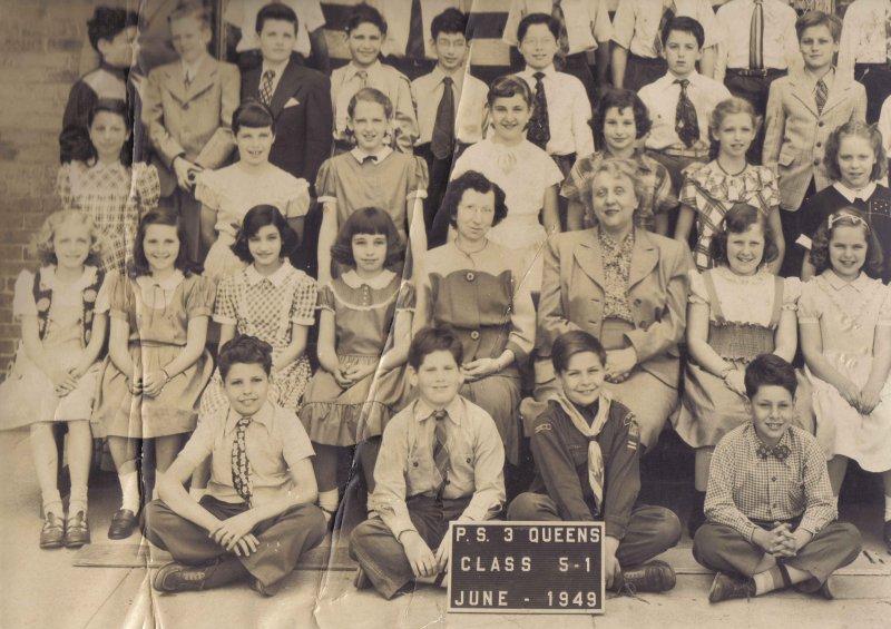
If any New Yawkers out there think they might know one of these
people, let me know... this photo and the snide inscription in the book make for an interesting puzzle.


 Bar by Mees