Hi All!
I promisedsome time ago that I would do a tour of the entire coast line of the American continent.
Not just the United States but all of it, starting at the most western tip of Alaska and ending at the most southern tip of Chile.
I wanted to start the tour after I finished my FS-GS session and sorted out all the scenery I wanted to use.
It turned out I downloaded and installed near to 300 scenery files ... only for Alaska! And there's more to come!
And yes, my psychiatrist knows about this.
So, a couple of days ago I started my trip at the US Coast Guard Loran Station at Attu Island.
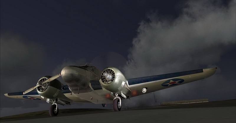
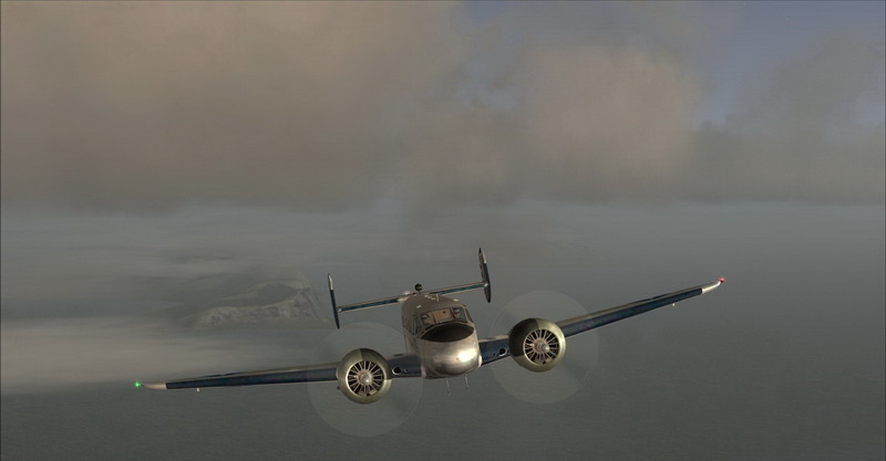
I decided to give my trusty C206 a rest and go with a little more classic bird: Milton Shupe's Beechcraft D18S.
I believe this to be a very, very nice aircraft that can compete with some of the best payware add-ons available.
Check this bird out! And it has a really nice warm glow when you fly at dusk or dawn.
Here's the story; I hope you like. Thank you for looking and please share your feedback!
Tour of the Pacific Coast - part 1: Attu Island
04:00 in the morning, or as some would say 'In the middle of the night'. I just needed to get up early because
I wanted to take off at dawn; the sight of the sun rising over the mountains is just something you don't want to miss.
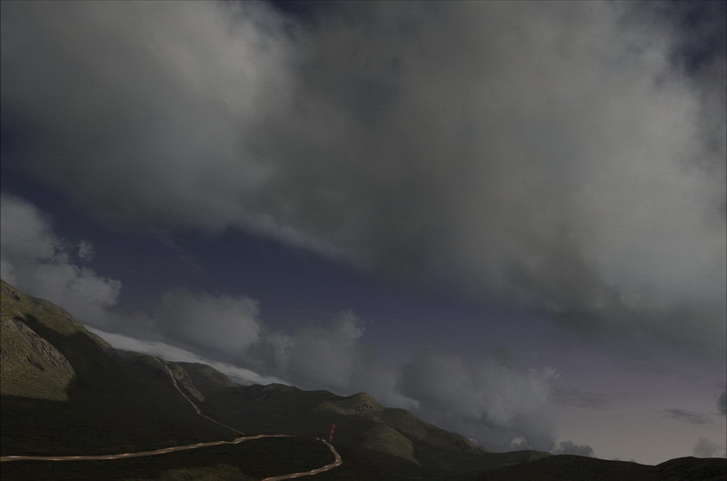
All is still quiet at Attu Island as opposed to last night when we had a pretty heavy storm ... but the sky is clearing now.
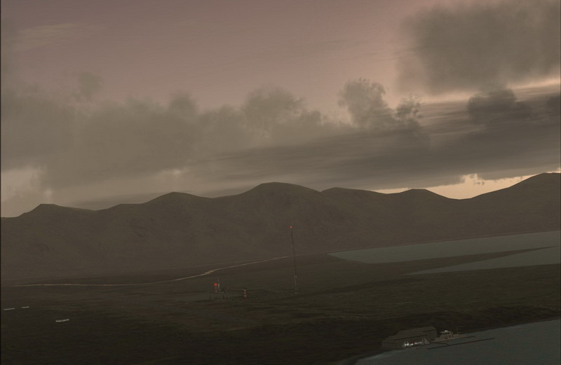
Down below is the United States Coast Guard LORAN Station, which I comprised it from two scenery files:
The Alaskan Docks 2: Aleutian Islands scenery, made by Dave Erickson and USCG LORAN Station Attu by Brian Smith.
The rest of the scenery is made up from FSGlobal Mesh, Ultimate Terrain Alaska & Canada and Ground Environment Pro.
The skies you're seeing are made by Flight Environment and ActiveSky, while the water is a beta package from Nick Needham.
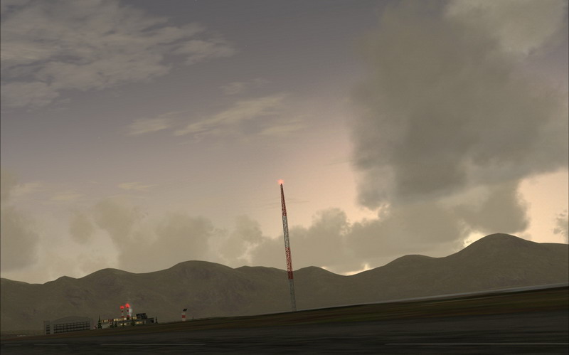
I'm already up (see the smoke coming out of the chimney?) and making coffee and sandwiches; I need to eat during my tour, right?
Suddenly all that was quiet is rudely disturbed by a couple of explosions and a very load roar: my D18S wakes up too ...
Full throttle ... thundering down the runway. You don't need to set any flaps here; it's a loooong runway!
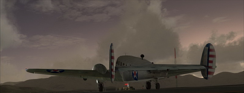
Take off!
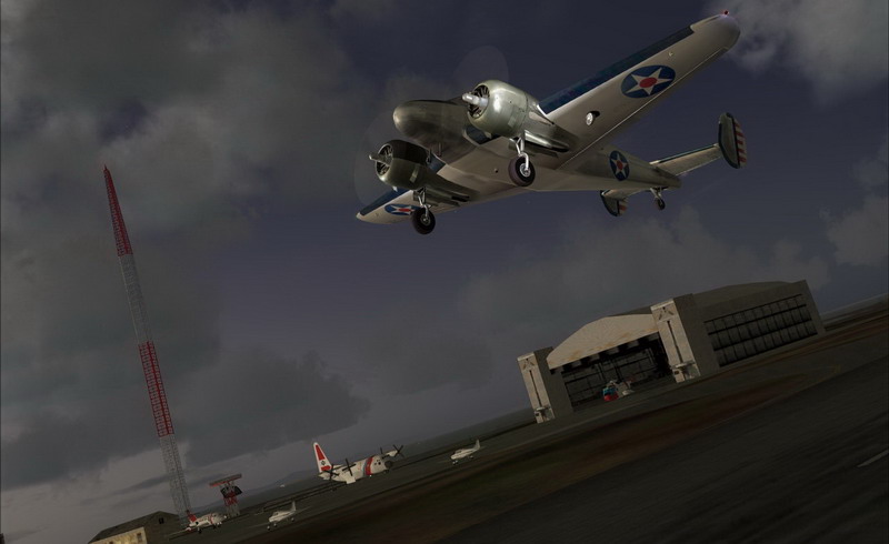
You can see the USCG HU-25 Falcon and C-130 Hercules parked at the ramp while their Sikorsky SH-3 Sea King shelters in the hangar.
There are also the two planes from some researchers who arrived last night. They got up just after me and will leave shortly.
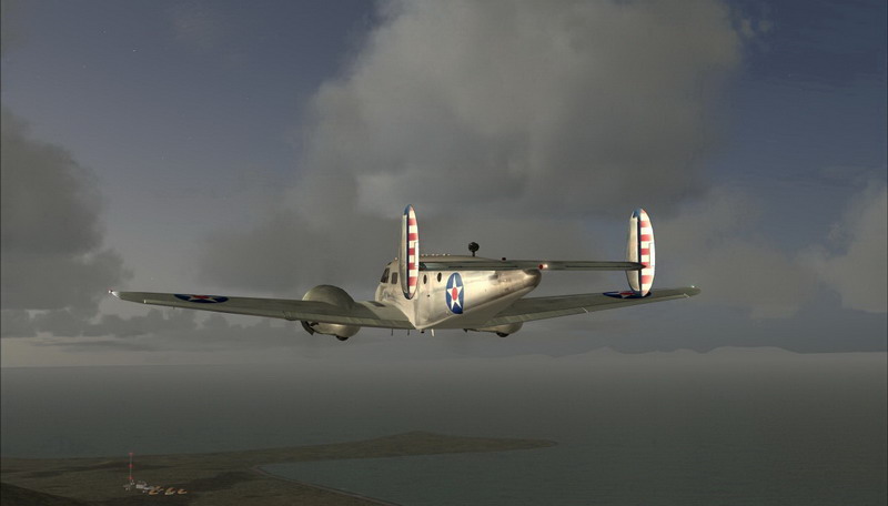
Turning over Masacre Bay flying towards the most eastern part of the island: Chirikof Point.
Just ahead you can see Alexai Point very clearly
Turning south ...
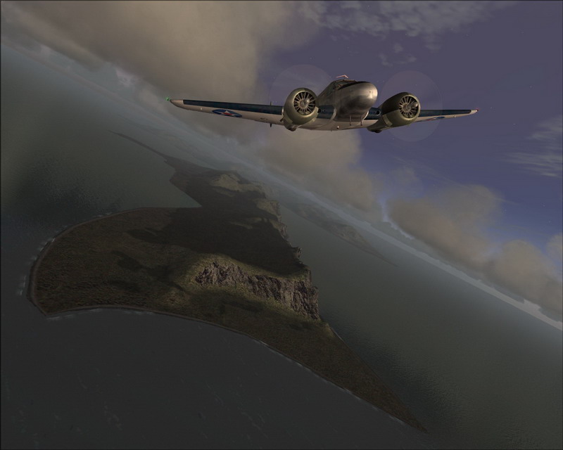
... and leaving Attu Island behind me. Heading towards Alaid, Nizki and Shemya Island
Stay tuned ... there's more to come!
I promisedsome time ago that I would do a tour of the entire coast line of the American continent.
Not just the United States but all of it, starting at the most western tip of Alaska and ending at the most southern tip of Chile.
I wanted to start the tour after I finished my FS-GS session and sorted out all the scenery I wanted to use.
It turned out I downloaded and installed near to 300 scenery files ... only for Alaska! And there's more to come!
And yes, my psychiatrist knows about this.
So, a couple of days ago I started my trip at the US Coast Guard Loran Station at Attu Island.
I decided to give my trusty C206 a rest and go with a little more classic bird: Milton Shupe's Beechcraft D18S.
I believe this to be a very, very nice aircraft that can compete with some of the best payware add-ons available.
Check this bird out! And it has a really nice warm glow when you fly at dusk or dawn.
Here's the story; I hope you like. Thank you for looking and please share your feedback!
Tour of the Pacific Coast - part 1: Attu Island
04:00 in the morning, or as some would say 'In the middle of the night'. I just needed to get up early because
I wanted to take off at dawn; the sight of the sun rising over the mountains is just something you don't want to miss.
All is still quiet at Attu Island as opposed to last night when we had a pretty heavy storm ... but the sky is clearing now.
Down below is the United States Coast Guard LORAN Station, which I comprised it from two scenery files:
The Alaskan Docks 2: Aleutian Islands scenery, made by Dave Erickson and USCG LORAN Station Attu by Brian Smith.
The rest of the scenery is made up from FSGlobal Mesh, Ultimate Terrain Alaska & Canada and Ground Environment Pro.
The skies you're seeing are made by Flight Environment and ActiveSky, while the water is a beta package from Nick Needham.
I'm already up (see the smoke coming out of the chimney?) and making coffee and sandwiches; I need to eat during my tour, right?
Suddenly all that was quiet is rudely disturbed by a couple of explosions and a very load roar: my D18S wakes up too ...
Full throttle ... thundering down the runway. You don't need to set any flaps here; it's a loooong runway!
Take off!
You can see the USCG HU-25 Falcon and C-130 Hercules parked at the ramp while their Sikorsky SH-3 Sea King shelters in the hangar.
There are also the two planes from some researchers who arrived last night. They got up just after me and will leave shortly.
Turning over Masacre Bay flying towards the most eastern part of the island: Chirikof Point.
Just ahead you can see Alexai Point very clearly
Turning south ...
... and leaving Attu Island behind me. Heading towards Alaid, Nizki and Shemya Island
Stay tuned ... there's more to come!


 [/url]