Google Earth - Fantastic!

If it doesn't fit .. It fits here .. - -

Google Earth - Fantastic!

Postby RollerBall » Thu Oct 06, 2005 3:40 pm

Have you noticed how, if you turn the image until it matches the angle the shot was taken on and then tilt it, it all becomes eerily 3-D. Here are 2 pics showing the old Kai Tak airport

Image

Image

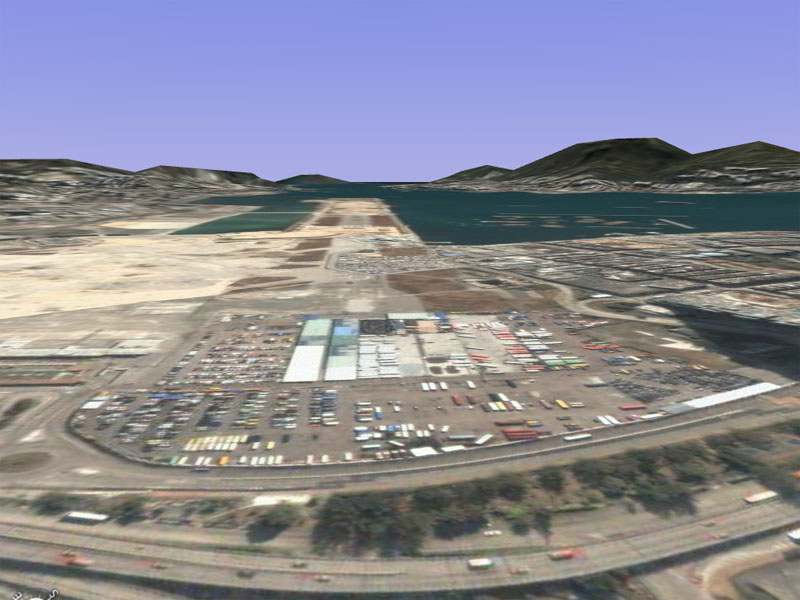
And in the second you get a terrific feel for the actual terrain as well.

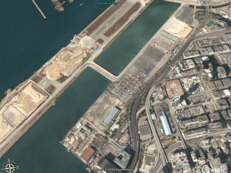
I've found the athletics track on the 13 IGS approach with its footie pitches, tennis courts and swimming pool and the very unusual 4-sided building just to the west of it but I'm danged if I can identify the hill that the checkerboard was on. Thought you would still have been able to see it but there you go.... :(

Edit.....

You can still see it after all- see (1) below. (2) is the athletics track, courts and pitches that pilots used to line up over for rwy 13 and (3) is the 4-sided building. Never knew it had a swimming pool next to it
Last edited by RollerBall on Thu Oct 06, 2005 4:01 pm, edited 1 time in total.
RollerBall
 

Re: Google Earth - Fantastic!

Postby Craig. » Thu Oct 06, 2005 3:45 pm

I like the new add 3d buildings option for certain cities. They arn't high def buildings or flight sim like but it does give you a feeling of being in the city.
User avatar
Craig.
Colonel
Colonel
 
Posts: 15569
Joined: Sun Sep 29, 2002 10:04 am
Location: Birmingham

Re: Google Earth - Fantastic!

Postby beaky » Thu Oct 06, 2005 5:01 pm

I just started messing around with flips, whichj allows you to load FS flight plans nto google Earth and view them in 3D.
It's absolutely amazing... might post some screenies of that.
Image
User avatar
beaky
Global Moderator
Global Moderator
 
Posts: 12877
Joined: Thu Dec 16, 2004 8:00 am
Location: Shenandoah, PA USA

Re: Google Earth - Fantastic!

Postby legoalex2000 » Thu Oct 06, 2005 5:04 pm

yeah the 3d buildings where just gray outlines. nothing special.

i found that if you do a direections seach, then hit play, it shows you the path to take by moving th camera from point to point.

:)ramos
legoalex2000
 

Re: Google Earth - Fantastic!

Postby RollerBall » Thu Oct 06, 2005 6:32 pm

:)

Yeah, I found that with the image tilted and at an eye level of say 2-300 feet you can 'fly' around among the hillsides of Kowloon (around Kai Tak) and look down on the houses and stuff. Amazing how many of them have got swimming pools and tennis courts - those guys out there must be making some money  ;)

Imagine if there was a way of linking FS to Google Earth so you actually see the real roads and buildings out of the cockpit window. Now that would really be something even if it was only done in the beginning for a few areas where the Google pics are detailed enough...
RollerBall
 

Re: Google Earth - Fantastic!

Postby ATI_7500 » Fri Oct 07, 2005 8:04 am

Screenie #2 looks like FS02 on a PII/450 with minimum details and photo terrain. O_o

Besides that, Google Earth misses the ion cannon button from Command & Conquer...
ATI_7500
 

Re: Google Earth - Fantastic!

Postby WebbPA » Fri Oct 07, 2005 9:20 am

Imagine if there was a way of linking FS to Google Earth so you actually see the real roads and buildings out of the cockpit window. Now that would really be something even if it was only done in the beginning for a few areas where the Google pics are detailed enough...


There is.  I've been using MyFSGoogleEarth with FS2002 for a few weeks.

Doesn't anyone read my posts?
WebbPA
Ground hog
Ground hog
 
Posts: 0
Joined: Sat Sep 25, 2010 6:01 pm

Re: Google Earth - Fantastic!

Postby Ben_M_K » Fri Oct 07, 2005 12:09 pm

Mmmmmm Google Earth....LOVE IT!
Ben_M_K
 

Re: Google Earth - Fantastic!

Postby RollerBall » Fri Oct 07, 2005 3:11 pm


Doesn't anyone read my posts?


Whose posts? Who are you? What year is this... :)

Just joking Jim..... DLd the stuff you mentioned, installed it as described. The documentation is more than hopeless I'm afraid - I couldn't understand at all how you're supposed to work it. Seems that including a simple set of instructions - you know Step 1 -- Step 2 --Step 3 is too complicated. When will clever people learn that ordinary folks (and that includes me) just don't care HOW things work... they just want it to do what it says on the tin.

Got the About screen, clicked on the button to select database as instructed and it immediately screwed up my FS2004. Everything hung and had to start task manager to stop the FSweb stuff. It closed down my FS2004 as well - both times I tried it.

Have had too many problems just lately with system crashes etc. Life's too short, so I've already deleted it. Pity - because it's a good idea.
Last edited by RollerBall on Fri Oct 07, 2005 3:40 pm, edited 1 time in total.
RollerBall
 

Re: Google Earth - Fantastic!

Postby WebbPA » Fri Oct 07, 2005 9:38 pm

Yeah, the docs could be a lot better.  If you don't have 2 networked comps or one 10Ghz comp it ain't gonna work.

I have 2 pretty low end networked comps running FS02 (you don't need FS02 on the client) and it looks pretty good - GE won't get more than 1 FPS but it still looks pretty good.  If you're having trouble with the network PM me.

You need WideFS to network this.
WebbPA
Ground hog
Ground hog
 
Posts: 0
Joined: Sat Sep 25, 2010 6:01 pm


Return to General Discussion

Who is online

Users browsing this forum: No registered users and 525 guests