Another FS flightplan issue

Forum dedicated to Microsoft FS2004 - "A Century of Flight".

Another FS flightplan issue

Postby Nexus » Tue Jan 18, 2005 10:44 pm

This about VOR to VOR flying.
Previously to flying the dreamfleet 727 I have only flied VOR flightplans with the C172, and those flights were in Sweden around my home airport.
Now we don't have pure DME's, just DVOR's at least around my neck of the woods.

But  when I do the cross-Europe flights with the 727 and flying after the flightplan FS generated to me, I often gets numerous DME stations after each other. Some times we're talking 250nm when I'm out of VOR range. How the heck am I supposed to fly my intended course when there's just a DME as a reference, and no I haven't spent half of my life in university so I don't posess the math skills to calculate this myself.  :(..and besides that's a bit over-kill for an FS flight  ;D

I refuse to look at the map to see if I'm straying off course, same goes for GPS. What to do?  ???
Nexus
Major
Major
 
Posts: 3240
Joined: Fri Jul 18, 2003 4:18 pm

Re: Another FS flightplan issue

Postby beefhole » Tue Jan 18, 2005 11:13 pm

After having this problem myself, I check over the flightplan very, very closely before hand to make sure my VORs are close enough. Knowing you Nexus, you've already thought of that. So my advive would be to come fly in the states, VORs are aplenty here  :P ;D
User avatar
beefhole
Major
Major
 
Posts: 3804
Joined: Thu Jun 05, 2003 8:57 am
Location: Philadelphia

Re: Another FS flightplan issue

Postby wji » Tue Jan 18, 2005 11:24 pm

"Some times we're talking 250nm when I'm out of VOR range." I've not experienced this myself creating VFR or IFR flightplans using FS9's flightplanner.

I don't live in Europe but have flown there many times over several years and cannot image where any route would be out-of-range from a VOR (60-90nm).

If we had the exact route to which you refer we could all check it out.

bill
p.s. most FS9 planes have distance measuring (DME) capability to interpret the VORTAC pulse from the station.
Image PhotoShop 7 user
User avatar
wji
Major
Major
 
Posts: 1644
Joined: Tue May 04, 2004 11:27 am

Re: Another FS flightplan issue

Postby Nexus » Tue Jan 18, 2005 11:44 pm

Just today I flew one from EDDT to LIRF (Berlin - Rome)
Screenshot was taken just mins ago, so don't pay attention to fuel burn etc  :)
Image

First VOR is obviously Tegel (TGL). Now the next 2 are both DME's meaning that the distance between TGL and the next VOR (TES) is some 420nm. I flew the 184 radial from TGL until the signal became out of range at some 150nm...of course the TES VOR was out of range aswell.

The result?

Good Ol' Nexus drifted several miles to the east due to the +40kt wind from the west  :(
Nexus
Major
Major
 
Posts: 3240
Joined: Fri Jul 18, 2003 4:18 pm

Re: Another FS flightplan issue

Postby beaky » Wed Jan 19, 2005 12:59 am

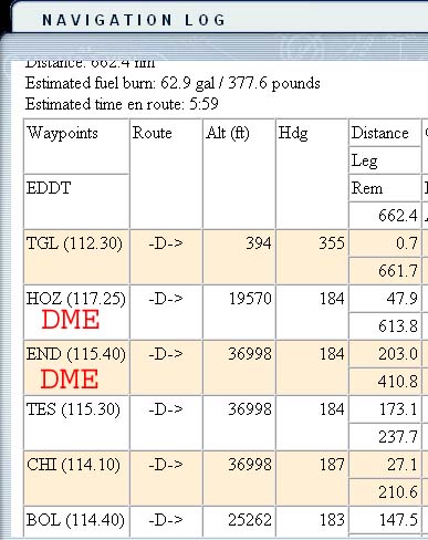
I know it might seem crazy to suggest doing this when you're flying a heavy on an IFR route, but without GPS or any radio navaid in range (not to mention no inertial guidance system), you have to rely on deduced reckoning, or "dead reckoning". You don't need a giant swollen mutant brain to figure your approximate position, ETA, etc. via dead reckoning, just a flight computer. An old-fashioned "whiz wheel" will do. It's too bad FS9 doesn't have some sort of flight computer, although I think the flight plan might(?) factor wind in determining your mag. heading (not sure as I have only used the planner and nav. log a couple of times). It's also too bad you can't display the map with only your courseline and not the airplane icon, because then it wouldn't really be cheating to look for some sort of landmark (assuming you can see the ground in the sim). You might still drift a couple of miles off course, esp. if you've got variable winds along your route, but fuel permitting, a couple of miles here and there at 727 speeds isn't the end of the world.  I have a question: does the route shown consist of any airways? It seems hard to believe that   IFR routes would be built around VOR waypoints so far apart...

Looking closer at your follow-up post, I have a second question: if you knew you had a 40-kt west wind throughout the flight, and you were holding an accurate, constant  heading while you had a VOR in range, how did you drift if you were holding that heading? No calculation required: "This heading has kept me crabbing along my true course line so far, so to compensate for wind, all I have to do is maintain this heading"  Excuse me if you know this already, but VOR signals can't really be trusted at the extreme limits of their range.  If you know you've been holding your heading
corrected for wind, and you see that needle deflecting when you're far from the station (according to DME), then that means you musn't start chasing it, it might be lying to you.  I may be wrong about this (don't think I've ever been "in a hole" between VORs in RL or FS9), but I believe you can get a false reading even if the "flag" shows you have the signal, and you've got the Morse ident. Other factors (terrain, etc.) can affect VOR signals as well, esp. far from the station.  Don't know if that's what happened, but... one of the rudimentary, no-tools-needed components of deduced reckoning is simply to stay with the heading that's been working so far. In that sense, even VORs are just a way of confirming your reckoning was correct.
Image
User avatar
beaky
Global Moderator
Global Moderator
 
Posts: 12877
Joined: Thu Dec 16, 2004 8:00 am
Location: Shenandoah, PA USA

Re: Another FS flightplan issue

Postby beefhole » Wed Jan 19, 2005 8:35 am

Yup, that's basically what I was going to say-fly the heading listed on the navlog and correct for winds aloft. This is probably how they do it in real life when the DMEs are spaced very far apart.
User avatar
beefhole
Major
Major
 
Posts: 3804
Joined: Thu Jun 05, 2003 8:57 am
Location: Philadelphia

Re: Another FS flightplan issue

Postby Nexus » Wed Jan 19, 2005 8:38 am

Thanks for the great reply Rotty!
As the 727 I fly does not have FMC, and I have yet to install the freeware INS, flying a regular flightplan with geographical waypoints (not navaids) are pretty tough since I don't have any real enroute charts. I only have my 2 VOR and ADFs available to help me.

Regarding the wind, as I departed Tegel, the wind was very light, even at the mid 300 levels. I don't have any wind indicator (at least I haven't yet found it  ;D) and the wind gradually changed since I kept the same heading when I was out of VOR range, or else I wouldn't have drifted since the flightplan called for a constant heading of 184 until I had passed TES VOR. But I veered off course BEFORE arriving at TES  :)

It's no big deal really, but it's kind of annoying  :P
Nexus
Major
Major
 
Posts: 3240
Joined: Fri Jul 18, 2003 4:18 pm

Re: Another FS flightplan issue

Postby beefhole » Wed Jan 19, 2005 8:58 am

Yup, this is why I check winds aloft before the flight.
User avatar
beefhole
Major
Major
 
Posts: 3804
Joined: Thu Jun 05, 2003 8:57 am
Location: Philadelphia

Re: Another FS flightplan issue

Postby Nexus » Wed Jan 19, 2005 8:59 am

Jeppesens data (the one I primarily use) very seldomly corresponds to the real world weather in FS.
Nexus
Major
Major
 
Posts: 3240
Joined: Fri Jul 18, 2003 4:18 pm

Re: Another FS flightplan issue

Postby beefhole » Wed Jan 19, 2005 9:10 am

That's why I use fs-I think I've explained this twice in the least month but here we go again-

1.Download real world weather, hit yes.

2. Go back into weather screen, hit "user defined" and then hit "customize weather."

3. Go to "advanced options", and now you can click on individual weather stations. Go to the winds section, and simply scroll up until you see the winds for your altitude. Simple! And no, it's not cheating b/c if you were flying in real life you would've had this information anyway.  :P
User avatar
beefhole
Major
Major
 
Posts: 3804
Joined: Thu Jun 05, 2003 8:57 am
Location: Philadelphia

Re: Another FS flightplan issue

Postby Nexus » Wed Jan 19, 2005 9:15 am

Ahh, well thank you!  :)
Nexus
Major
Major
 
Posts: 3240
Joined: Fri Jul 18, 2003 4:18 pm

Re: Another FS flightplan issue

Postby beefhole » Wed Jan 19, 2005 9:20 am

No problem  ;)

As a heads up the exp may not have been perfect, but I'm sure you'll figure it out, it all gets you to the same place  ;D
User avatar
beefhole
Major
Major
 
Posts: 3804
Joined: Thu Jun 05, 2003 8:57 am
Location: Philadelphia

Re: Another FS flightplan issue

Postby Ivan » Wed Jan 19, 2005 10:06 am

There's a lot more to complain about... Long Range ADF radios (there is a limit to these, and that's the USA/Euro one, not the russian limit (more range))
Russian planes: IL-76 (all standard length ones),  Tu-154 and Il-62, Tu-134 and [url=http://an24.uw.hu/]An-24RV[/ur
Ivan
Lieutenant Colonel
Lieutenant Colonel
 
Posts: 5805
Joined: Sun Apr 13, 2003 8:18 am
Location: The netherlands

Re: Another FS flightplan issue

Postby Reap » Wed Jan 19, 2005 11:06 am

Nexus
I think the answer you are looking for is in 3rd party software. The FS route planner is not very real world and not very good to fly by.

I use FSNavigator and in my opinion you can't get better for route planing. I just put your route EDDT to LIRF in and within 5 mins have a VOR to VOR route.
Here it is:
depart Rwy 26L on the Brane SID (maintain 261 from Tegaluntil Brane intersection. 27.8nm
183 to LEG 63.0 nm
182 to OKG 82.3nm
175 to RDG 61.7 nm
189 to MDF 48.9 nm
202 to OZE 117.7 nm
161 to VIC  48.8 nm
194 to BOA 68.0 nm
164 to BOL 119.7 nm
CAMP FLL SID for Rwy 16L

Of course you should be flying Aiways rather than VOR to VOR and you should be using Sids and Stars for arrival and departure but this is pretty simple with FSNavigator, all the airways and sids stars can be updated every month to keep them inline with real world operations.
You can turn the aircraft image off so that you can use the map just for reference without cheating and the flight planner gives you all your headings and frequencies for easy reference.
http://www.fsnavigator.com
and no I have nothing to do with FSNavigator other than using it.
UPLOAD IMAGE TO SIMV!
User avatar
Reap
2nd Lieutenant
2nd Lieutenant
 
Posts: 251
Joined: Wed Nov 12, 2003 3:47 pm
Location: Derby. United Kingdom

Re: Another FS flightplan issue

Postby beaky » Wed Jan 19, 2005 2:46 pm

Thanks for the great reply Rotty!
As the 727 I fly does not have FMC, and I have yet to install the freeware INS, flying a regular flightplan with geographical waypoints (not navaids) are pretty tough since I don't have any real enroute charts. I only have my 2 VOR and ADFs available to help me.

Regarding the wind, as I departed Tegel, the wind was very light, even at the mid 300 levels. I don't have any wind indicator (at least I haven't yet found it  ;D) and the wind gradually changed since I kept the same heading when I was out of VOR range, or else I wouldn't have drifted since the flightplan called for a constant heading of 184 until I had passed TES VOR. But I veered off course BEFORE arriving at TES  :)

It's no big deal really, but it's kind of annoying  :P


There is an option that's sort of a cheat., but useful. If you can't get a weather report from an airport that's close enough to matter (refer to beefhole's post), you can hit Shift+Z anytime, and an overlay will come up showing the same info you see as in Slew mode, including local wind at your altitude. The sim will continue running in its normal state: no slewing or pausing. I'll admit I use it, but only after I've tried to figure it out first.  As far as the map goes, I agree it's not as useful as a real chart, and even a whiz wheel won't help you much if you can't correlate a visual landmark with a map you can measure from. But like whiz wheels, charts are not expensive. If you fly mostly in the same region, one World Area Chart might be a good investment (check online; Sporty's Pilot shop sells individual charts by mail, and there are probably a bazillion others, including those who sell downloadable charts for a fee). IFR charts tend to lack details found on VFR charts, but it'd probably be better than the FS9 map. And  having to re-fold those suckers while flying really adds a touch of realism...   :D

PS: echoing Reap and others... try to fly established airways whenever possible, rather than picking your own VOR-to-VOR route. They're set up to avoid leaving you out of range, and they're part of the FS9 map database (although FSNav sounds very handy also).
Last edited by beaky on Wed Jan 19, 2005 2:49 pm, edited 1 time in total.
Image
User avatar
beaky
Global Moderator
Global Moderator
 
Posts: 12877
Joined: Thu Dec 16, 2004 8:00 am
Location: Shenandoah, PA USA

Next

Return to FS 2004 - A Century of Flight

Who is online

Users browsing this forum: No registered users and 761 guests