If anyone's curious, here's a world map showing the route of EQDC3, with landings shown as circles. Each leg crossed the equator at some point, and the entire route was within a few degrees of the equator.
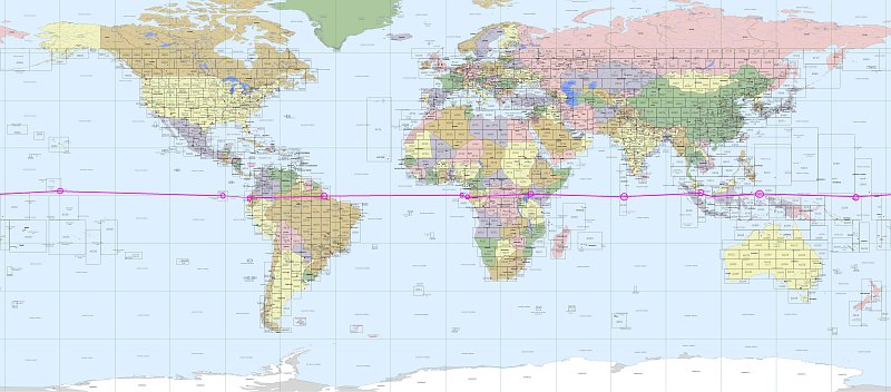
Total nautical miles flown: 21,650.7
Total time enroute: 205.5hrs
IFR: 29.7
Night: 54.0
Day: 121.8
Average groundspeed: 105.3 knots
Longest Leg: SEOE-PLCH; 3,986,9 nm
Shortest Leg: FOOG- FPST; 139 nm
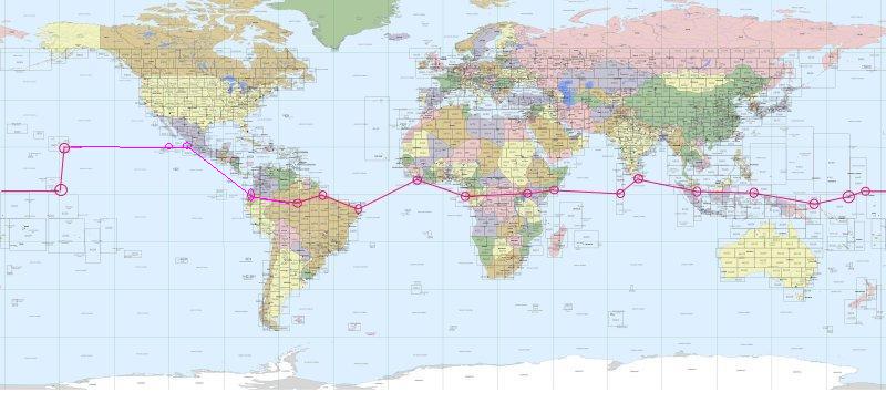
Did a little thinking after, to try to figure out what route the support plane, a PBY Catalina (with no extra fuel tanks- OK, maybe they'd need a little extra for the leg from Isla Revilla Gigedo to Hawaii), would've made, flying ahead of EQDC3. A pretty amazing voyage in itself- maybe I should try flying that sometime in the PBY...
Here's their route:
The plane is the default FS9 DC3, with some modifications... I expanded the volume of the center tank to 800 gallons, then added two more 800-gallon tanks aft of that. Not sure if it would all physically fit at those stations, but whatever; I only wanted to get so involved in all that. Just wanted to fly this big pup as close to the Equator as possible, without totally cheating by selecting Unlimited Fuel.
To stay within the published "normal overload" gross weight of 33,000 lbs (!!) for this type (used quite often back in the day, especially flying over The Hump and on the North Atlantic routes of that period), I shaved some pounds off the empty weight (removed the seats, etc.- the default bird is set up as an airliner) and kept my baggage and supplies at 200 lbs. max.
Here's a picture I found somewhere showing the sort of thing that's been done before to extend the range of the DC3:

That's 10 55-gallon (?) drums of fuel; that's an extra 550 gallons, or 3,300 lbs. Don't remember where I found this, so I don't know what the story is behind it.
There have been many interesting mods of RL DC3s and C47s; i'm just getting into researching all that. What an amazing history this airplane has...and many of them are still going strong, working and playing and just trudging along.
I only used the GPS once, out of sheer desperation, after cheating my way out of a fuel-starvation ditching east of Christmas Island. Lame, yes, but it made for an interesting little storyline there... and my average for navigation and fuel management was pretty damn good, if I do say so... only ran out one other time, bellying the DC3 into the water just next to Babullah Airport after a missed approach at night. Had I had the sense to make sure there was some sort of lighting at my destination on that leg, it'd have gone better, I think...
All navigation was done by pilotage and ded. reckoning, supplemented only by ADF and "radio compass" (old-school VHF receiver that picks up VORs but not radials), and of course via ATC radar when in IMC.
Materials used for the flight: A couple of world atlases, a calculator, and my trusty whiz-wheel.
So... now that I've done that, what's next...?
I think I need to fly upside-down under some bridges for a while... in something very small and very fast...


