Remembering Steve Fossett...
A regular trip for me, following the route taken by Steve Fossett in 2007, with fatal consequences...>>
http://en.wikipedia.org/wiki/Steve_Fossett
The "Plan-G v 2.0.5" Satellite map, showing the Sierra Nevada Mountain range. and my progress through it in real time (The yellow aircraft)...>>>
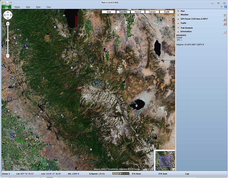
....from Yerington (O43) Nevada, to Modesto (KMOD) California.
Buffeted by the killer up-draft and down-drift winds, common to the area...>>>
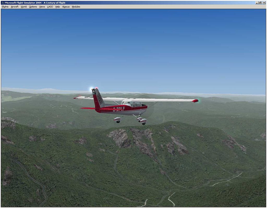
Struggling to maintain control!...>>>
Did I survive? (Check with BBC News!).
I remember following the news, daily, for the search, etc, in 2007/2008
The whole episode still fascinates me, even today, illustrating the dangers of flying in mountainous areas with dangerous atmospheric conditions!
Popular with Gliders, but very dangerous for small GA Piston Prop Aircraft!
Paul... ...!
...!
http://en.wikipedia.org/wiki/Steve_Fossett
The "Plan-G v 2.0.5" Satellite map, showing the Sierra Nevada Mountain range. and my progress through it in real time (The yellow aircraft)...>>>
....from Yerington (O43) Nevada, to Modesto (KMOD) California.
Buffeted by the killer up-draft and down-drift winds, common to the area...>>>
Struggling to maintain control!...>>>
Did I survive? (Check with BBC News!).
I remember following the news, daily, for the search, etc, in 2007/2008
The whole episode still fascinates me, even today, illustrating the dangers of flying in mountainous areas with dangerous atmospheric conditions!
Popular with Gliders, but very dangerous for small GA Piston Prop Aircraft!
Paul...
...!