Page 1 of 1
What is that!?

Posted:
Sun Oct 12, 2008 10:46 pmby homebrewer
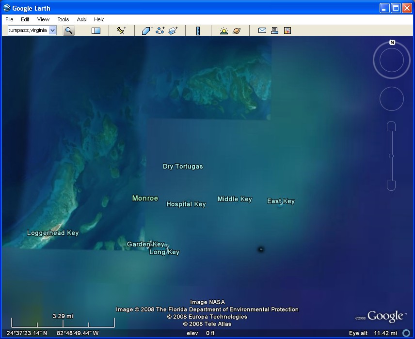
Google Earth @ 24d 37m 42.70s N x 82d 52m 27.08s W. It's something way, way out in the Gulf of Mexico, west of Key West. Looks man-made in my version of GE...
Re: What is that!?
Posted:
Sun Oct 12, 2008 10:56 pmby BFMF
Post a screenshot

Re: What is that!?
Posted:
Mon Oct 13, 2008 12:10 amby elite marksman
It's Fort Jefferson on Garden Key.
The hi-res picture aerial picture isn't quite in line with the low-res satellite photo. It lines up almost perfectly with the satellite view of the island just to the East.
Re: What is that!?
Posted:
Mon Oct 13, 2008 7:53 amby ShaneG_old
The black dot?
:-?
Re: What is that!?
Posted:
Mon Oct 13, 2008 9:29 amby homebrewer
Fort Jefferson on Garden Key. Who put it there? How long ago? I need to do a Google search...
A short, one-page introduction to Fort Jefferson. Good reading...
http://www.shannontech.com/ParkVision/D ... tugas.html
Re: What is that!?
Posted:
Mon Oct 13, 2008 11:34 amby Al_Fallujah
M$ Virtual Earth has an object out there too.. Not sure.
I do see other boat traffic in some shots. Maybe it is someone's yacht.
Re: What is that!?
Posted:
Wed Oct 15, 2008 4:36 pmby NitroPower
I cant put the coordiantes in my Google Earth Pro v4.2