SHUT UP!
OK. So what! I'm not a real pilot, but it's more fun sometimes to pretend.
This whole thing will be like training wheels on a kids bicycle. It'll get you moving in the right direction.
Later, you'll be able to fly a real plane on a dark rainy night during a power failure. When you land, you'll know that you owe it all to me.
There's a lot to remember in navigation, and it'll be totally unfamiliar to most people.
If I had a better memory, I wouldn't need to cheat. But cheating seems like the best way to do some things. Like navigation.
For some reason I could never keep some things straight, like ADF, NDB, or DME. But after a while it'll sink in.
Take this - The ADF is set into the NDB, and it'll show up in the DME. Yeah, that makes sense????
If anyone's interested, I'll see if I can make it simple.
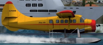
So here I am, flying north from from Yaoundé in Cameroon when I decide to head to Douala, Cameroon. Yup! I'm a regular world traveler.

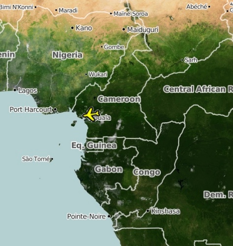
Not having been to Yaoundé before this, I'm a little uncertain how to get there. On top of it all, I left my map case at home.
To make it worse, the plane only has basic navigation gear, not GPS.
Luckily, I just happen to have a laptop in the plane. AND on that laptop is both FSX, and PlanG!

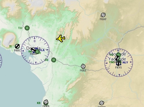
So what does PlanG tell me?
Lots of stuff
First off, is the green arrow.
It means "Land in this direction, or you'll be shot down!" Whatever. I'm not going to argue the point.
When you move your pointer over it you get some very useful navigation info.
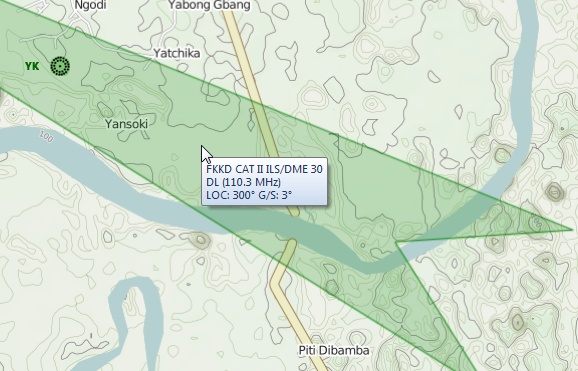
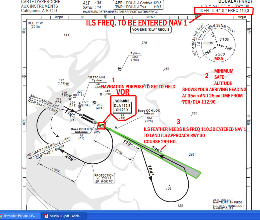
This information is from the VOR. VOR stands for VHF Omni Directional Radio Range. And the VHF at the beginning stands for Very High Frequency.
This is the VOR symbol.
 The station name is DLA.
The VOR sends out very high frequency radio signals. PlanG is telling us that THIS signal is being broadcast at 110.3 Mhz. Mhz means megahertz. Yeah, just like your computer.
For now, what you want to do is to put that number, 110.3 into Nav1.
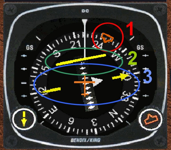
That info will be responsible for number 2 and 3 in this instrument.
What I'm going to give you is the simplified version. Remember, I'm not a real pilot, so I can get away with it here.
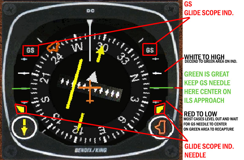
#1 is the heading that I set to show me the direction of the airport FROM where I was when I started TO the airport.
It's just a guide marker/number that I want to use to show me what direction to fly in. BUT, it's ONLYa marker. If I fly in some other direction it doesn't move, AND is no longer useful!
#3 shows the course (direction) that I need to fly to land. When I get in the general vicinity of the airport, I'll need this to line up with the runway. The arrow and the "wheel" that it's "on" will be pointing directly up.
That white triangle slightly to the right of the orange stick "airplane"? that means that the airport is (to some degree) ahead of me. If I pass the airport, it'll be on the other side, indicating that I'm moving away from the airport.
(Yeah, I know. There's a lot of little stuff to remember.)
#2 now this is the good part! That short yellow line will move closer to the main yellow line as you and the runway line up.
Now for the fun part! We set that number, 300, (the course) into the CRS/OBC/Localizer (for our purposes here all three things are the same thing).
We start to set up for a landing.
The runway is still ahead of us, but WE'RE OFF TO THE RIGHT OF THE RUNWAY.
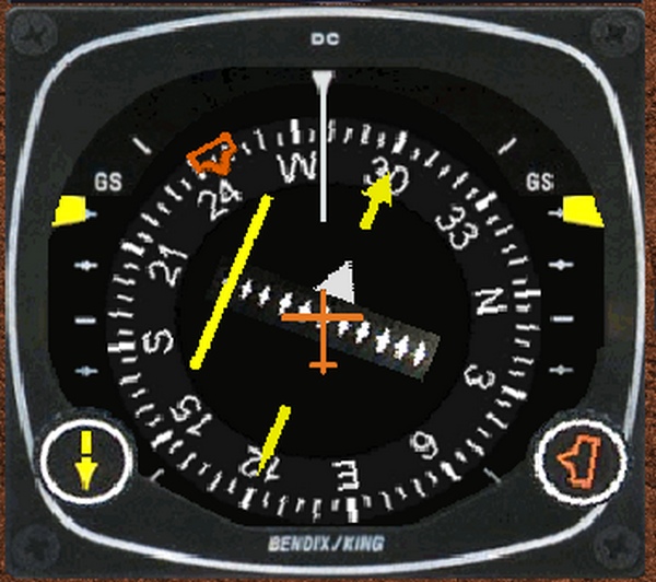
Well, the runway is at an angle of 300 degrees. And we are flying on a course of 300 degrees. But we're still to the right of the runway.
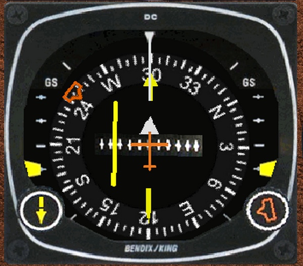
By heading off to the left we'll get closer to the runway.
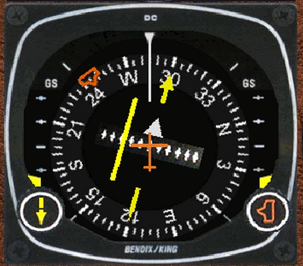
Woops! we went a little too far. The runway is on our right now.
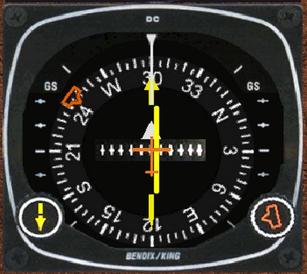
NOW! Now we're perfectly inline with the runway and on a course of 300 degrees. Well, close enough for this lesson.

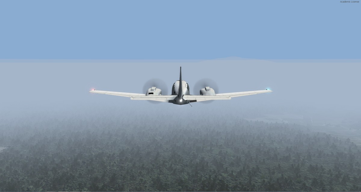
This is the kind of weather we were flying in.
Navigation isn't just about getting there. It's about getting out of the plane alive.
On the other hand, navigation can be as much fun as actually getting there.
Learn a little bit, and have fun. You can always learn a little bit more later.