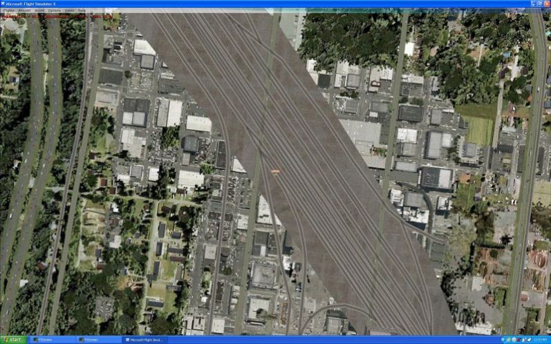
This is an FSX vertical screenshot over the Seattle rail yard. It shows up (using UTX) as a gray flat area with the outline of tracks. It is obvious that some satellite imagery was overlaid on both sides of the tracks.
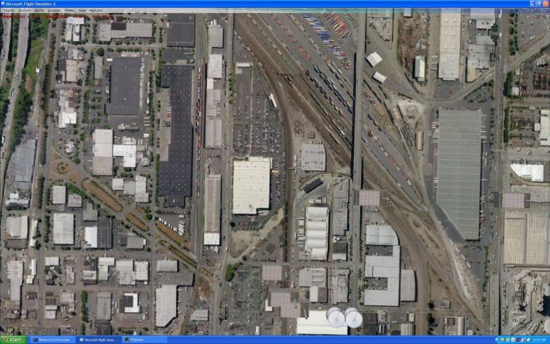
This is a TileProxy screenshot of the same area as the previous screenshot. It shows the area, as it actually was when the sat photos were taken. Note that the rail complex just south of downtown Seattle is very complex covering a very large area, which is not apparent in the FSX screenshot. I could not believe the detail that I was able to bring up.
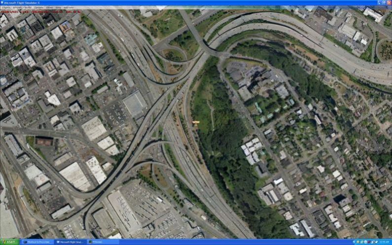
This is a TileProxy screenshot of a complex roadway interchange just southeast of downtown Seattle. I am amazed at the detail.
The next two screenshots show a comparison between a FSX and TileProxy Steerman approach to the Boeing Field/King County Intl AP. Images on the ground show up very good with TileProxy at this low altitude. If my computer used a quad core 3.0 CPU, the images would be perfect. Anyway that