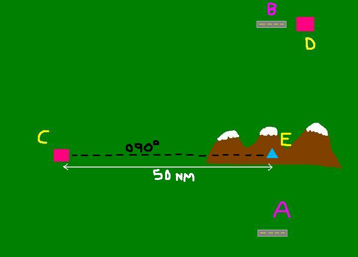
Well in this situation VOR 'C' can't really be used, unless you want to fly direct to VOR 'C' and then direct to VOR 'D' which would make the journey longer than what it need be. You could however create a sort of intersection using VOR 'C' as long as it was equipt with DME. Simply tune into VOR 'C' and select 090
o inbound radial, now before you fly you should have a look at the map and measure the distance from point 'E' (Which I have drawn on the map, 50 nm or so) So when you take-off from Airfield 'A' head due north and keep monitoring the DME and VOR Needle in the cockpit (If you want to make it easier simply use your map to work out the distance from intersection 'E' to Airfield 'A' and then you can roughly work out how long it will take you to arrive at the intersection using, Time = Distance divided by Speed.) So when you near the intersection your DME should (If you've stayed roughly on course) read around 50nm as the VOR needle become centered. So you know know where you are (and thats Intersection 'E'!) So hopefully by now you could tune into VOR 'D' and make it to Airfield 'B'.
Another method would be simply fly it VFR. You know the Airfield 'B' is pretty much north of Airfield 'A'. So just fly north, and have a look at a map before and when your flying to keep a check on where abouts you are, and compensate for any wind or other factors effecting your course.
Or easiest way of all.... GPS