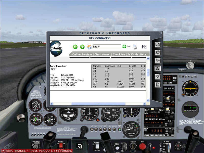
Page 1 of 1

Rwy ILS Hdg

PostPosted: Sat Feb 18, 2006 6:33 am
by G-EORGE
Is there anyway to find out the ILS magnetic heading of a Rwy (e.g Rwy23 - 226o) from the GPS?.  
I know that the airport and Rwy information page shows frequencies, and the Rwy numbers, but I haven't actually found the exact headings, and have to pause the flight, use the world map etc...

Thanks

Re: Rwy ILS Hdg

PostPosted: Sat Feb 18, 2006 7:49 am
by Capt. Farhan
NO, the heading is not available in GPS......you have to pause the simulator.

Re: Rwy ILS Hdg

PostPosted: Sat Feb 18, 2006 8:37 am
by Nav
Don't readily see how calling up the map is any slower or less convenient than clicking away at the GPS, G-EORGE!  :)

In any case, the runway number gives you a rough guide, if you add a nought. The approximate direction of 'Runway 33' would be 330 degrees, for example. 'Runway 18' would be about 180 degrees, 'Runway 1' would be about 10 degrees.

The exact bearings can vary by a few degrees (usually 2 or 3, occasionally up to 5), because the numbers are 'rounded' - but the runway number should give you a start for preliminary lining up etc.

Re: Rwy ILS Hdg

PostPosted: Sat Feb 18, 2006 9:00 am
by G-EORGE
OK, thanks very much

Re: Rwy ILS Hdg

PostPosted: Sat Feb 18, 2006 9:51 am
by commoner
You could add something like FS Charts to your kneeboard and then you could access it online from the kneeboard without pausing the sim.............mine looks like this........


Image

.......look in the main aircraft folder for an HTML file called kneeboard_keys.htm.....open it then right click and choose view source.........add this line at the bottom....

 FS CHARTS  

 close the file and yes to save the changes..........

 on the kneeboard under the A icon, you will find a link to go to FS Charts. Scroll down to find it.

  On the site go for Quick Search enter the ICAO code and then click the link it gives you for the info.............commoner ;)

...You can add other sites to your kneeboard in the same way...just change the URL and name.........you can even Google away the long haul hours... ;D

Re: Rwy ILS Hdg

PostPosted: Sat Feb 18, 2006 11:44 am
by Zaphod
Nice one commoner. I've just done as you described and it works great.
Cheers.
Zaphod (Paul) ;D

Re: Rwy ILS Hdg

PostPosted: Sat Feb 18, 2006 12:04 pm
by commoner
Nice one commoner. I've just done as you described and it works great.
Cheers.
Zaphod (Paul) ;D


Cheers Paul..it's been around a while that one, but these things get forgotten after a while as they  disappear into the bowels of old posts..........enjoy.....commoner ;)

Re: Rwy ILS Hdg

PostPosted: Sat Feb 18, 2006 2:08 pm
by wji
"You could add something like FS Charts to your kneeboard and then you could access it online from the kneeboard "

Hey . . . now you're talkin'

Re: Rwy ILS Hdg

PostPosted: Sat Feb 18, 2006 3:34 pm
by Gypsy_Baron
Is there anyway to find out the ILS magnetic heading of a Rwy (e.g Rwy23 - 226o) from the GPS?.  
I know that the airport and Rwy information page shows frequencies, and the Rwy numbers, but I haven't actually found the exact headings, and have to pause the flight, use the world map etc...

Thanks


If you select that runway as your approach and activate it, then
look at the GPS flightplan page, you should see the runway heading
displayed in the list, or at least a very close approximation.

  Paul

Re: Rwy ILS Hdg

PostPosted: Sat Feb 18, 2006 6:11 pm
by beefhole
Don't readily see how calling up the map is any slower or less convenient than clicking away at the GPS, G-EORGE!  :)

For some people, like myself, having to pause the sim is extremely disruptive and, well let's just say I really, really don't like doing it.  Using the GPS, on the other, hand, the sim is still going.  It's more realistic, but more importantly you keep the continuity.