Useful Navigational (vfr) help
Whilst searching on Google yesterday, i found a program called 'google earth', manufactured and made by the same team as the popular search engine. Having downloaded the program purely out of interest, i was astonished to find how detailed it really is. Put simply, it is a collection of aerial sattelite photos placed on a dynamic 3d globe. In many places elevation has been added, enabling you to tilt the screen and view relief of the land. In addition, many US cities have virtual buildings.
Just to give you an idea, i uploaded these screenshots
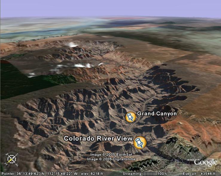
The famous Grand Canyon, tilted so the relief can be seen in detail
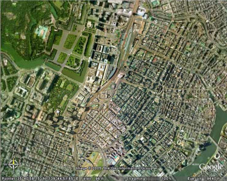
A top-down, aerial view of the Tokyo palace and the streets surrounding it
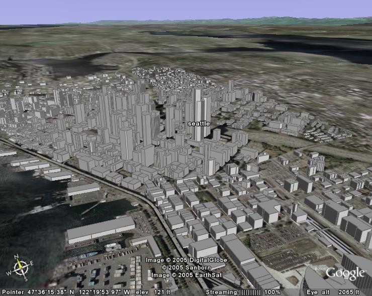
Seattle city with the virtual buildings i mentioned before added:
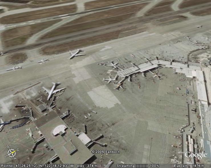
Seatttle Tacoma airport- this clearly demonstrates the level of detail
This program has really helped me with vfr navigation, where previously i had to use the fs maps. There are three versions- a free version (the one ive got), which gives massive detail on every major city and medium detail everywhere else. Ver.2 costs about $20 and provides clearer detail on minor cities. The final version is $114!, but provides the ultimate in satelite photography, which makes it fantastic for vfr maps, and other relevances to FS. The program can be downloaded at http://www.earth.google.com, and i would recommend it to anybody who flies using vfr a lot. The file is about 6Mb, and runs off broadband internet connection, so bear that in mind before you download.
Thanks for reading
Daz
[glb]Ps. to the moderators: Im sorry if this is the wrong forum to post this in , but it seemed the most relevant one. [/glb]
Just to give you an idea, i uploaded these screenshots
The famous Grand Canyon, tilted so the relief can be seen in detail
A top-down, aerial view of the Tokyo palace and the streets surrounding it
Seattle city with the virtual buildings i mentioned before added:
Seatttle Tacoma airport- this clearly demonstrates the level of detail
This program has really helped me with vfr navigation, where previously i had to use the fs maps. There are three versions- a free version (the one ive got), which gives massive detail on every major city and medium detail everywhere else. Ver.2 costs about $20 and provides clearer detail on minor cities. The final version is $114!, but provides the ultimate in satelite photography, which makes it fantastic for vfr maps, and other relevances to FS. The program can be downloaded at http://www.earth.google.com, and i would recommend it to anybody who flies using vfr a lot. The file is about 6Mb, and runs off broadband internet connection, so bear that in mind before you download.
Thanks for reading
Daz
[glb]Ps. to the moderators: Im sorry if this is the wrong forum to post this in
, but it seemed the most relevant one. [/glb]