All of these are very good suggestions. Back in the day they didn't have GPS so sometimes when I am flying vintage aircraft (DC-3 for example) I will fly VOR to VOR.
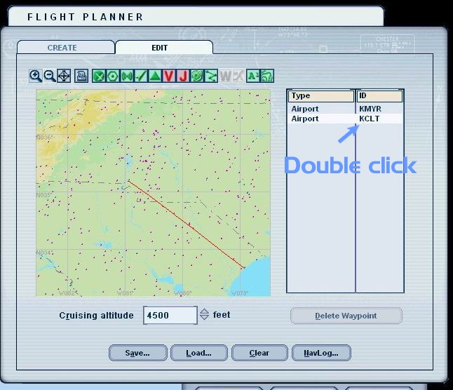
Go to the Flight Planner. Fill in your departure airport and destination airport. Select VFR. Near the bottom left of the Flight Planner select VOR to VOR. Click Find Route. The map view will show a squiggly red line directing your flightpath from one VOR to the next. You can then enter your altitude (be sure to follow FAA altitude guidelines when flying in the US!) then click NavLog.
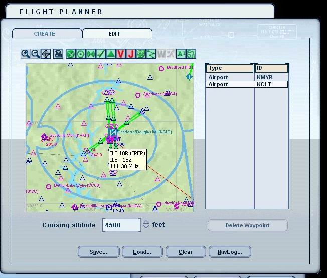
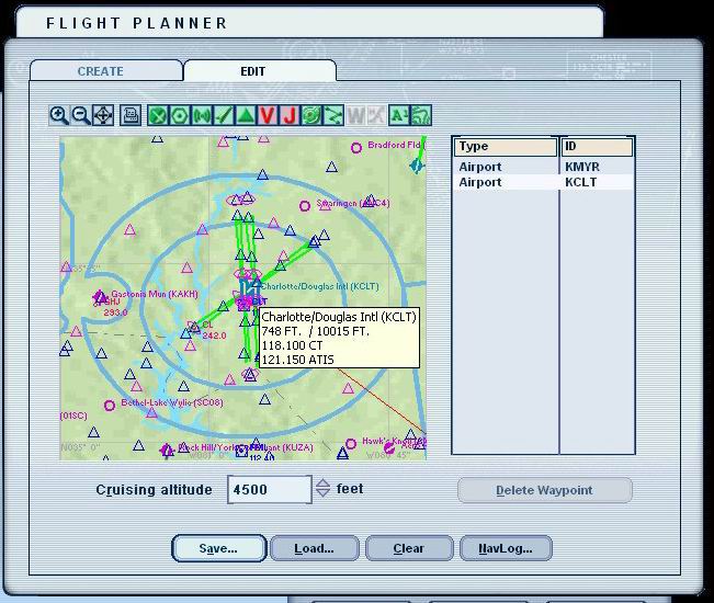
The NavLog will display the VOR's in sequence (along with their appropriate frequencies)! All you have to do now is make a printout like Gary suggested. Then go back to the Edit screen and double click your destination airport like Pete recommends. You can then write the destination airport frequencies on the printout! Cool stuff, dudes and dude-ettes!
If you want to be really critically detailed do like I do and pull up this website:
http://www.airnav.com/Click Airports in the menu below. Enter the FAA Identifier of the Airport (i.e. PHNL or KDAL) in the blank. Hit the 'Enter' key on your keyboard.
A page will be displayed including the airport's Approach Frequencies, all COM and NAV frequencies, and even the weight limitations of aircraft landing on the runways. They just completed an update in June 2004 which even includes a FAA approved airport diagram.
You can print out this page or do as I do and copy the URL and place it in a Airports folder in your main FS9 directory.
Now this website only lists airports for the United States and some US affiliated areas. I would love to locate a URL for a website that lists international airport information like this. So far I haven't found one.
If anybody knows where I can pick up an international website listing detailed airport information please let me know.


 Thanks Graycat, this is the information I was looking for. Have added the URL to my kneeboard.